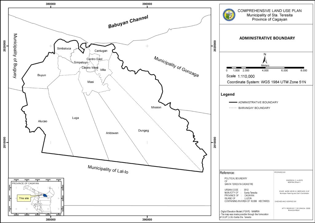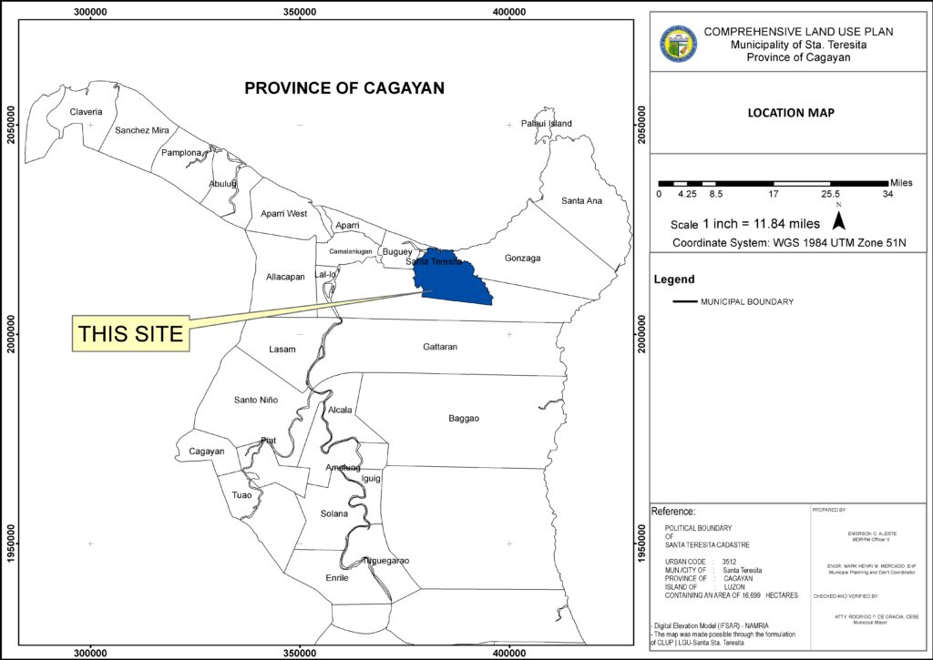
The municipality of Santa Teresita is situated in the northeastern part of the province. It lies on a geographical coordinate of 121 degrees 53 minutes east longitude and 18 degrees 15 minutes north latitude. It is approximately 118 kilometers from the Regional Center. It is bounded on the north by municipalities of Buguey and Gonzaga, and the east and southeast by the municipality of Buguey, and on the south by the municipality of Lallo.
The location of the municipality is the middle portion of northeastern Cagayan which is approximately halfway between the Dugo, Camalaniugan junction, and the northeastern tip of the province at San Vicente, Santa Ana, Cagayan. This location makes it accessible from the regional center at Tuguegarao City through the National Highway and the Dugo- San Vicente Road, or through the Magapit-Mission Diversion Road. The municipality is also accessible to the Cagayan Economic Zone and Freeport at Casambalangan, Santa Ana, Cagayan.
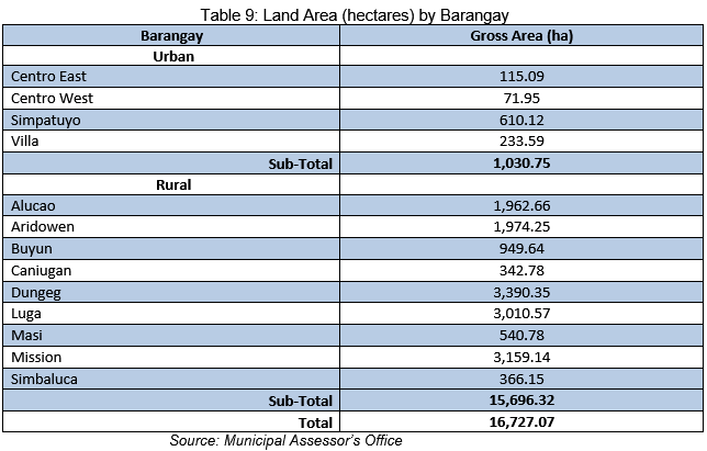
The municipality of Santa Teresita is politically subdivided into 13 barangays, four (4) of which are urban barangays, and the remaining nine (9) are classified as rural barangays. Based on the record of the Municipal Assessor’s Office, the total land area of the municipality covers an area of 16,727.07 hectares. The Poblacion area which constitutes the four (4) urban barangays has an aggregate area of 1,030.75 hectares while the nine (9) remaining rural barangays extend up to 15,696.32 hectares.